Actually.....
First, what a height map is:
WikiPedia on HeightmapsAnd here are some examples:
In Uru: Ercana
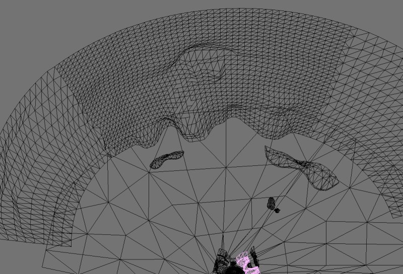
- ercana.jpg (123.74 KiB) Viewed 5847 times
And then, if you've ever played Far Cry:
Article about heightmaps used in FC
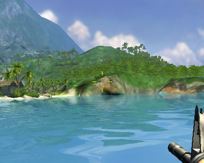
- FarCry_terrain_lod_ratio_5.jpg (82.22 KiB) Viewed 5847 times
Heightmaps are nothing more than meshes displaced with a grayscale (or similar) map. They are usually very clean because people just use a grid mesh, starting with an entirely quad surface, and usually stay that way (depends on if you tweak them).
The easiest ways to tell a mesh thats been constructed with a height map:
-
If it has no triangular faces (although height/displacement maps
can be applied to
modeled objects, not just planes, kinda like the noise modifier in 3dsmax)
-
Evenly spaced polygons. The mesh started as a perfect grid, so even when displaced, it will
look perfect when viewed from above. (unless tweaked)
-
If its a convex surface. Meaning not concave. Meaning if there is a part of the terrain
somehow hanging over a lower part, that is almost *never* caused by a height map.
Meaning either it was tweaked, or just plain modeled out by hand.
-
Steep angles - not that you can't get very steep angles using a heightmap, but you will never
get a 90 angle if you just use a map and displace it on the z axis.
So, when you look at Relto, ask yourself if there are any concentrations of triangles, bigger or smaller polygons, overhangs, or nearly 90 degree angles. The most you could say was that it was *EXTREMELY* tweaked. The simple thing is why bother? Modeling by hand is often (not always, but usually) superior for terrain the player is actually going to be standing on.
Everyone who has used bryce or terragen has had some experience with height/displacement maps. But the simple thing is they have their limitations and you can't expect to get perfect results from them. Anything Cyan's used displacement maps for has been heavily tweaked and modified to get the right appearance.
Except for things like the Er'cana panorama, or the terrain around the cleft, almost all of Cyan's terrain work is modeled completely by hand. Which actually is rather evident from the stylized form Uru terrain tends to have. Which can be a good and bad thing for realism. Ahnonay (space particularly) is an example of very well done modeling and texturing. In the case of most Uru puddles it's just plain awful though.
I'm not sure about this, but I do think some games (like FarCry) have engines that have their own way of handling heightmaps. I might be wrong about. I know that the NeoAxis engine definitely has a way of handling heightmaps. But I know that Uru doesn't have anything like that. Yet.


