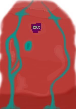
"The upper and lower cliffs define the top and bottom boundaries of the explorable space, while the creeks/rivers to the right and left define the left and right boundaries. These boundaries can be easily crossed by bridges or ladders during later phases, as desired. The big purple square is the ERC; the pavilion isn't shown as I thought that it would be most enjoyable if it felt isolated. This could probably be achieved the best mainly by moving it further away from the influence of the main building and into the shielding woods. Which of course would mean releasing it in the next phase."

So let me see here...we need to define these boundaries a little better, and then figure out how to wind the path around our land. Therefore, I need a volunteer to take this rough area map and make a larger, clearer, version, showing how the streams wend around, and adding in the outline of the cliffs and positioning the waterfalls. Sort of a blueprint diagram of the area.
After the landscape is completed, we can then decide how to wind the path so that it passes through interesting views, figure out where to put the display areas in, and finally start pinning down the smaller details i.e., placement of trees, lamps, rock formations, etc.