
Like the sound of the other video functions too - I've always thought the KI should have video streaming/storage.
Dedicated new & improved (?) KI thread.
-
TomahnaGuy

- Posts: 91
- Joined: Sun Sep 30, 2007 2:41 am
- MOULa KI#: 0
- Location: Tomahna/UK
- Contact:
Re: Dedicated new & improved (?) KI thread.
There was a webcam? HOW long have I been plugging a webcam then I find out there was one? 
Like the sound of the other video functions too - I've always thought the KI should have video streaming/storage.
Like the sound of the other video functions too - I've always thought the KI should have video streaming/storage.
-
Tsar Hoikas
- Councilor of Technical Direction
- Posts: 2180
- Joined: Fri Nov 16, 2007 9:45 pm
- MOULa KI#: 23335
- Location: South Georgia
- Contact:
Re: Dedicated new & improved (?) KI thread.
TomahnaGuy wrote:There was a webcam? HOW long have I been plugging a webcam then I find out there was one?
Back in Prologue/Uru Live Beta, there was an image on the DRC Site that was streamed from one of the neighborhoods via a "Live Webcam." Back in UU, you could turn the webcam SDL on. The cam itself needed a special client to work, obviously.


Re: Dedicated new & improved (?) KI thread.
I'm with Grogyan. I don't think we should take IC elements too far. The current KI is just, well, ugly, and structurally cumbersome - both visually and in practice.
I'm advocating the old design because, overall, it's much more myst-like. Design wise it has a lot more character as both a visual creation and a plausible D'ni device.
Although I haven't used the interface, it looks substantially more intuitive. It's also prettier and more striking as a would-be holographic device. In the end, I think good aesthetics and a strong sense of overall focus - both in terms of design/D'ni realism elements and layout - can outway IC details. I think Uru has in part suffered from a lack of right-brained leanings and artistic looseness. Sometimes what "feels" better is the right way to go (of course not always, but at this point I think it's time to reawaken this vital concept).

Re: Dedicated new & improved (?) KI thread.
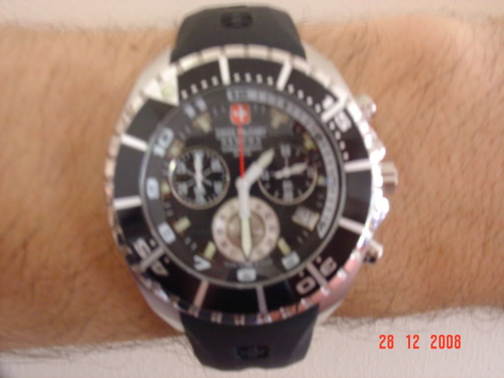
Here's an idea, how about we take photos and post them of our watches that mostly represents the KI (I still advocate the old design)
I'll go first
My Swiss Military was a souvenir I got from Switzerland, the face of the watch can rotate and has markings (for grip) that match the marker blips
Inside the watch are 3 small dials with hands on each
I'll go first
My Swiss Military was a souvenir I got from Switzerland, the face of the watch can rotate and has markings (for grip) that match the marker blips
Inside the watch are 3 small dials with hands on each
Better to have loved and lost than never to have loved at all
Re: Dedicated new & improved (?) KI thread.
I have but two thoughts on this. First, If we do design a new Kie from scratch, "Keep it small" The one thing I really dont want is a giant Kie poping up, why? one word, Lag. Pluse I am a geek and like smaller tech.
Secondly, It would take time, but I do think a "Start from Scratch" or "Modified KI" is something to be focused on. It would be great if it was one of the first things we seriously work on for Uru.
Tyion.
Secondly, It would take time, but I do think a "Start from Scratch" or "Modified KI" is something to be focused on. It would be great if it was one of the first things we seriously work on for Uru.
Tyion.
Re: Dedicated new & improved (?) KI thread.
And the KI still doesn't tell you the time of day until you open up the Big KI
Better to have loved and lost than never to have loved at all
Re: Dedicated new & improved (?) KI thread.
Here's a mock up of an idea with using the current KI
The lower right button is what could be the marker game interface red/white
The middle right button is what could be used to open up A specific tab like the Jalak tab
The Top right button to stay as is to open and close the KI
And then you have the GPS numbers for span, Toran and Height where I have marked
The numbers can easily be replaced by hands similar to a chronograph watch
The lower right button is what could be the marker game interface red/white
The middle right button is what could be used to open up A specific tab like the Jalak tab
The Top right button to stay as is to open and close the KI
And then you have the GPS numbers for span, Toran and Height where I have marked
- KI_Calibrating.png (132.2 KiB) Viewed 3891 times
The numbers can easily be replaced by hands similar to a chronograph watch
Better to have loved and lost than never to have loved at all
Re: Dedicated new & improved (?) KI thread.
I like it! though we may want to make that go both ways, some of us go by digital time rather then hands.

Re: Dedicated new & improved (?) KI thread.
I am more interested in the way the KI interfaces with the game. In Jalak we were able to call up that control interface I would like a floating panel with the D'ni numbers on with a button that would allow you to change to our normal (for the want of a better description) numbers for the D'ni numerically challenged.
The aim is to set puzzles in new ages with choices made with those number keys. The route I am currently exploring is one where you make a simple journal entry consisting of your KI number and the puzzle answer and post this on a viewer. The message viewer would need some sort of parse function.
I was looking at the use of the KI number as an error check to stop spurious messages. I don't know if this is possible and I am in the process of trying to make a broken viewer as the input device without using Cyan textures.
In my original story line I was going to use an existing viewer in the pub on the great stairs in Ae'gura but the advent of the FCAL restrictions kiboshed that idea.
Re: Dedicated new & improved (?) KI thread.
The Kie deffinitly has alot of possibilities. We could build whole game Ages based on KI Games. but lets save that prospect for another topic. 